| dc.contributor.advisor | Οικονόμου, Εμμανουήλ | |
| dc.contributor.author | Κιούση, Δήμητρα | |
| dc.date.accessioned | 2023-03-07T09:20:27Z | |
| dc.date.available | 2023-03-07T09:20:27Z | |
| dc.date.issued | 2023-02-28 | |
| dc.identifier.uri | https://polynoe.lib.uniwa.gr/xmlui/handle/11400/3828 | |
| dc.identifier.uri | http://dx.doi.org/10.26265/polynoe-3668 | |
| dc.description.abstract | Οι υδρογραφικές αποτυπώσεις και η χαρτογράφηση του θαλάσσιου πυθμένα, ιδίως σε
παράκτιες περιοχές, αποτελούν ιδιαίτερα σημαντικούς κλάδους που συμβάλλουν στην
εξασφάλιση της ασφαλούς ναυσιπλοΐας και την προστασία του περιβάλλοντος, ενώ
συνεισφέρουν παράλληλα και σε θαλάσσιες δραστηριότητες, όπως η οικονομική
ανάπτυξη -λιμενικά έργα-, η εύρεση υδρογονανθράκων, οι ποντίσεις καλωδίων, η
διαχείριση της παράκτιας ζώνης, καθώς και η θαλάσσια έρευνα, άμυνα και ασφάλεια.
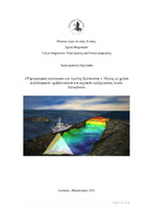
Η περιοχή μελέτης της παρούσας διπλωματικής εργασίας είναι ο Κυπαρισσιακός
Κόλπος Δυτικής Πελοποννήσου (ν. Ηλείας) και πιο συγκεκριμένα ο λιμένας
Κατάκολου, όπου και πραγματοποιήθηκε αποτύπωση ακριβείας και αναπαραγωγή
τρισδιάστατου μοντέλου θαλάσσιου πυθμένα, με την χρήση πολυδεσμικού
ηχοβολιστικού (multibeam sonar) και η εφαρμογή εξειδικευμένου λογισμικού
υδρογραφίας, για την επεξεργασία νεφών δεδομένων και διορθώσεων. | el |
| dc.format.extent | 109 | el |
| dc.language.iso | el | el |
| dc.publisher | Πανεπιστήμιο Δυτικής Αττικής | el |
| dc.rights | Αναφορά Δημιουργού - Μη Εμπορική Χρήση - Παρόμοια Διανομή 4.0 Διεθνές | * |
| dc.rights | Attribution-NoDerivatives 4.0 Διεθνές | * |
| dc.rights | Attribution-NonCommercial-NoDerivatives 4.0 Διεθνές | * |
| dc.rights | Attribution-NonCommercial-NoDerivatives 4.0 Διεθνές | * |
| dc.rights | Attribution-NonCommercial-NoDerivatives 4.0 Διεθνές | * |
| dc.rights.uri | http://creativecommons.org/licenses/by-nc-nd/4.0/ | * |
| dc.subject | Υδρογραφία | el |
| dc.subject | Βαθυμετρία | el |
| dc.subject | Pockmarks | el |
| dc.subject | Κατάκολο | el |
| dc.subject | Πολυδεσμικό ηχοβολιστικό (multibeam) | el |
| dc.title | Υδρογραφική αποτύπωση του λιμένος Κατάκολου Νομού Ηλείας με χρήση πολυδεσμικού ηχοβολιστικού και τεχνικών επεξεργασίας νεφών δεδομένων | el |
| dc.title.alternative | Hydrographic survey of the port of Katakolo, in Ileia Prefecture, with the use of a multibeam echosounder and cloud data processing techniques | el |
| dc.type | Διπλωματική εργασία | el |
| dc.contributor.committee | Παγούνης, Βασίλειος | |
| dc.contributor.committee | Ανδριτσάνος, Βασίλειος | |
| dc.contributor.faculty | Σχολή Μηχανικών | el |
| dc.contributor.department | Τμήμα Μηχανικών Τοπογραφίας και Γεωπληροφορικής | el |
| dc.description.abstracttranslated | Hydrographic survey and seabed mapping, especially in coastal areas, are
Hydrographic sectors of great importance. They contribute in the reassurance of the
navigation safety and the environmental protection, while playing a primary role in
marine activities, such as economic development – marine construction -, hydrocarbon
detection, cable impregnations and marine research, defense and safety.
The study area of the diploma thesis is the Kyparissiakos Gulf of West Peloponnesus
(Ileia Prefecture) and more specifically the port of Katakolo, where a precise surveying
and the recreation of a 3D model was made, with the use of a multibeam sonar and the
application of specialized hydrographic software, in order to process and correct point
cloud data. | el |


