| dc.contributor.advisor | Παγούνης, Βασίλειος | |
| dc.contributor.author | Τσιριμώνας, Βασίλειος | |
| dc.date.accessioned | 2024-03-28T10:28:22Z | |
| dc.date.available | 2024-03-28T10:28:22Z | |
| dc.date.issued | 2024-03-14 | |
| dc.identifier.uri | https://polynoe.lib.uniwa.gr/xmlui/handle/11400/6213 | |
| dc.identifier.uri | http://dx.doi.org/10.26265/polynoe-6049 | |
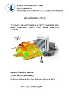
| dc.description.abstract | Η παρούσα Διπλωματική Εργασία εκπονήθηκε και παρουσιάστηκε στο
πλαίσιο της ολοκλήρωσης του Προγράμματος Προπτυχιακών Σπουδών
του τμήματος Μηχανικών Τοπογραφίας και Γεωπληροφορικής της
Σχολής Μηχανικών του Πανεπιστημίου Δυτικής Αττικής (ΠΑ.Δ.Α) με
εμβάθυνση στην Τοπογραφία- Γεωδαισία. Αντικείμενό της είναι η
παρουσίαση σύγχρονων γεωδαιτικών μεθόδων συλλογής και
επεξεργασίας 3D δεδομένων για την αποτύπωση, καταγραφή και
απόδοση της υπάρχουσας κατάστασης μνημείων πολιτιστικής
κληρονομιάς, με στόχο την ολοκληρωμένη γεωμετρική τεκμηρίωση τους.
Στόχος της είναι η αποτύπωση με επίγειο τρισδιάστατο σαρωτή λέιζερ
μίας καινοτόμας μεθοδολογίας για την γεωμετρική τεκμηρίωση
κτισμάτων στο Ηράκλειο Αττικής και συγκεκριμένα αποτυπώθηκε ο
Ιερός Καθολικός Ναός Αγίου Λουκά. Ο απώτερος σκοπός είναι η 3D
αναπαράσταση και μοντελοποίηση του Ναού και η εισαγωγή του σε
περιβάλλον ΒΙΜ για μοντελοποίηση των κατασκευαστικών
πληροφοριών, αλλά και παραγωγή 2D σχεδίων (όψεις- κατόψεις) εάν
θέλουμε. Τέλος τα παράγωγα μπορούν να χρησιμοποιηθούν για
μελλοντική χρήση από επιστήμονες άλλων ειδικοτήτων (αρχιτέκτονες,
πολιτικούς μηχανικούς, αρχαιολόγους, κ.α.) | el |
| dc.format.extent | 72 | el |
| dc.language.iso | el | el |
| dc.publisher | Πανεπιστήμιο Δυτικής Αττικής | el |
| dc.rights | Αναφορά Δημιουργού - Μη Εμπορική Χρήση - Παρόμοια Διανομή 4.0 Διεθνές | * |
| dc.rights | Attribution-NonCommercial-NoDerivatives 4.0 Διεθνές | * |
| dc.rights.uri | http://creativecommons.org/licenses/by-nc-nd/4.0/ | * |
| dc.subject | ΒΙΜ | el |
| dc.subject | Scan to bim | el |
| dc.subject | Μοντελοποίηση | el |
| dc.subject | Ιερός Καθολικός Ναός Αγίου Λουκά | el |
| dc.subject | 3D Laser scanner | el |
| dc.subject | Γεωμετρική τεκμηρίωση μνημείων | el |
| dc.title | 3D Αποτύπωση και μοντελοποίηση BIM Ιερού Καθολικού Ναού Αγίου Λουκά Ηράκλειο Αττικής | el |
| dc.title.alternative | 3D Presentation and BIM modeling of the Holy Catholic Church of St. Luke Irakleio Attica | el |
| dc.type | Διπλωματική εργασία | el |
| dc.contributor.committee | Ανδριτσάνος, Βασίλειος | |
| dc.contributor.committee | Γιαννίου, Μιχαήλ | |
| dc.contributor.faculty | Σχολή Μηχανικών | el |
| dc.contributor.department | Τμήμα Μηχανικών Τοπογραφίας και Γεωπληροφορικής | el |
| dc.description.abstracttranslated | The present undergraduate Diploma Thesis was carried out and
presented in the context of the completion of the Undergraduate Program
of the Department of Surveying & Geoinformatics Engineering of the
School of Engineering of the University of West Attica (UNIWA) with
specialization in Surveying- Geodesy. Its object is the presentation of
modern geodetic methods of collection and processing of 3D data for the
mapping, recording and rendering of the existing state of cultural heritage
monuments, with the aim of their complete geometric documentation.
Its purpose is to scan with 3D terrestrial laser scanner (TLS) an
innovative methodology for geometric documentation of buildings in
Irakleio Attica and specifically was captured the Holy Catholic Church of
St. Luke. The ultimate goal is 3D representation and modeling of Church
and its introduction into a BIM environment for building information
modeling, but also the production of 2D drawings (faces, floor plans) if
we want. Finally, the derivatives can be used for future use by scientists
of other specialties (architects, civil engineers, archaeologists, etc.) | el |


